ZiaMap works alongside the tools you already use.
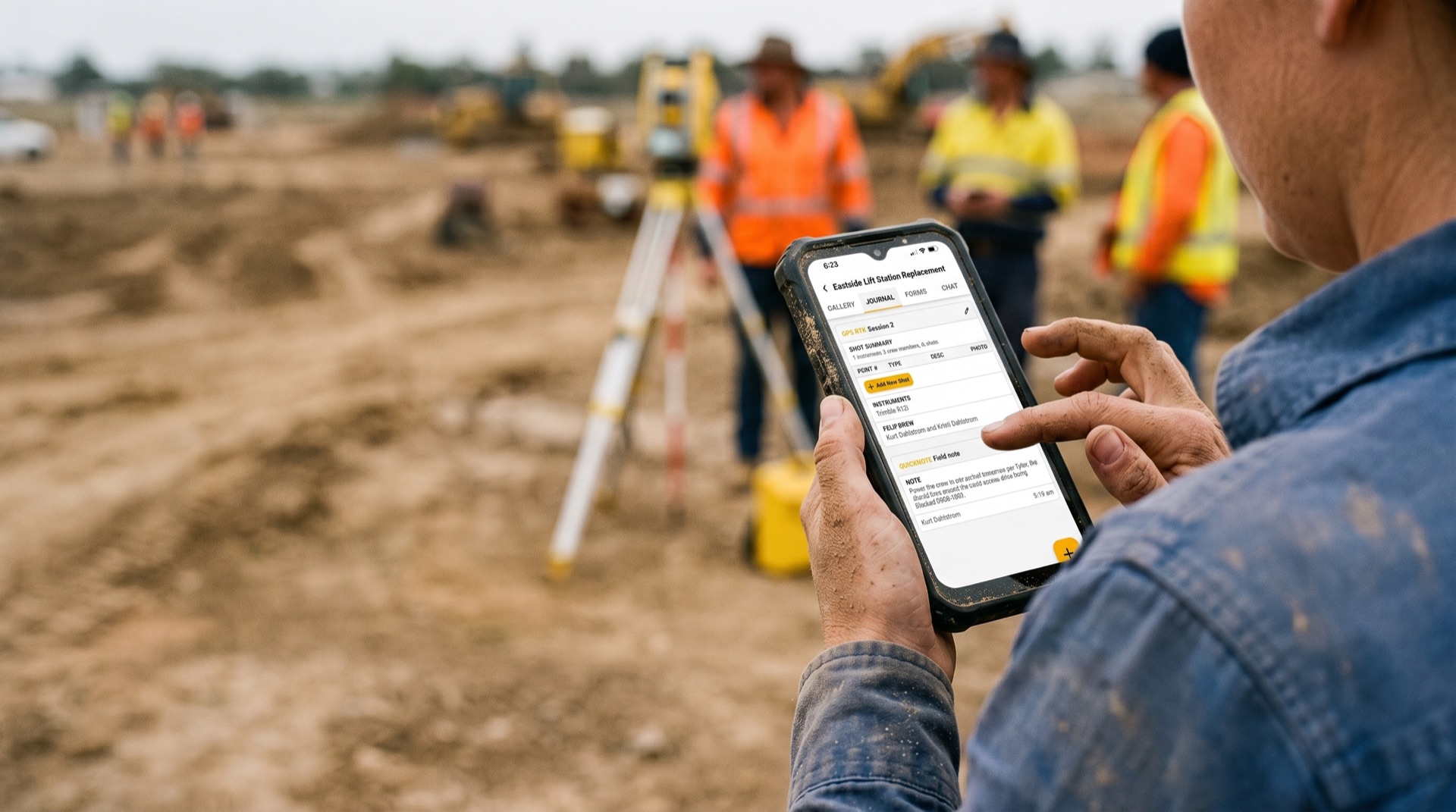
Your instruments capture the coordinates. Your office software processes and drafts. ZiaMap captures everything in between: photos, notes, field sessions, and signed tickets, organized by project, synced to the office.
GET BETA ACCESSTHE LAYER NONE OF THEM COVER
Trimble Business Center processes your coordinates. AutoCAD Civil 3D drafts the plans. Procore manages the project. None of them capture what happens on the ground: the conditions, the photos, the crew notes, the signed tickets. That is what ZiaMap does.
YOUR EXISTING STACK
Instruments, data collectors, office software, project management. Keep all of it. ZiaMap does not replace any of it.
ZIAMAP: FIELD DOCUMENTATION
GPS-tagged photos, chronological Field Journal, signed tickets, and field notes. The record that lives between instrument capture and office processing.
YOUR INSTRUMENTS CAPTURE THE POINTS. ZIAMAP CAPTURES EVERYTHING AROUND THEM.
THE SOFTWARE YOUR FIRM ALREADY RUNS
ZiaMap works in conjunction with the platforms civil engineering and land surveying firms use every day. No API required. No data migration. Just a documentation layer that fills the gap.
TRIMBLE BUSINESS CENTER
TBC processes your survey data. ZiaMap captures the field record around it: photos, conditions, crew notes. Both belong in your workflow.
AUTOCAD CIVIL 3D
Civil 3D handles design and drafting. ZiaMap handles what the design is based on: the site photos, the as-found conditions, the field observations that inform every plan set.
ESRI / ARCGIS
Esri manages your spatial data at the enterprise level. ZiaMap captures the GPS-tagged field record that feeds it: photos pinned to coordinates, tied to the project, logged by crew member.
PROCORE
Procore runs the construction project. ZiaMap documents the survey and civil work that happens on the same site: signed restake tickets, field photos, crew notes.
CARLSON SOFTWARE
Carlson handles data collection and processing. ZiaMap handles the documentation layer around that data: what the crew saw, what they captured, what was signed off before they left.
ANY OTHER PLATFORM
ZiaMap does not require integration with your existing software. It runs independently on the device every crew member already carries and syncs the record to the office on its own.
THE HARDWARE YOUR CREW ALREADY CARRIES
ZiaMap runs on the smartphone in every crew member's pocket. Your data collectors stay exactly where they are.
TRIMBLE
TSC7, R10, R12i, and the full Trimble data collector line. Your instrument runs the survey. ZiaMap runs the documentation alongside it.
LEICA
CS30, GS18, and the Leica Captivate platform. Same logic. Leica captures the coordinates. ZiaMap captures the everything else.
TOPCON
FC-6000, HiPer HR, and the Topcon controller line. ZiaMap works alongside all of it. No trade-in. No new hardware.
WHERE EACH FITS
Different tools for different jobs. ZiaMap fills the documentation gap none of the others cover.
| Capability | Your Instruments / Office Software | ZiaMap |
|---|---|---|
| Survey-grade coordinates | Primary | Complementary |
| GPS-tagged field photos | Limited | Primary |
| Chronological Field Journal | No | Yes |
| Offline-first field capture | Yes | Yes |
| In-field signature collection | No | Yes |
| Project-level documentation | Limited | Primary |
| Real-time office visibility | Varies | Built in |
| Per-firm pricing | No (per-seat or enterprise) | Yes |
WHO ZIAMAP IS BEST FOR
Survey and civil firms that already have the instruments and the office software. What they do not have is a documentation layer that ties field work to the office record in real time. That is what ZiaMap does.